Showing posts with label teaching. Show all posts

29 January, 2007

New data on the revision habits of the modern student

In one of the courses I taught last semester, the exam has asked pretty much the same questions every year for the last five years. This doesn’t exactly reflect well upon those doing the teaching, and this year (my second of covering these lectures) I made a deliberate decision to do something a bit different with the questions from my part of the course. The exam is divided into two sections: a ‘numerical’ part focussed on data manipulation and calculating things, and an ‘essay’ part. For the former, instead of asking the usual question about triple junction stability and migration, I gave them a question where they had to assess the quality of some paleomagnetic data and use them to calculate when a terrane (a highly allochthonous one, no less) collided with a larger continent.

I realised at the time that this alteration could potentially act as a useful survey of the study practices of our undergraduates. The question I set was actually pretty easy – if you’d bothered to revise the part of the course about paleomagnetic field tests and calculation of paleolatitudes (I’d even, after some debate, given them the relevant equation, and therefore wondered if it wasn’t a little too easy). However, students in thrall to the art of ‘question spotting’, who only revised the small bit of the course about triple junctions, might be in a little bit of trouble.

Today I received the scripts from the exam; no-one had answered my numerical question. Not one student.

Although that means I have less marking to do, part of me can’t help but find that a little bit depressing. The weird thing is, plenty of people answered one or both of the essay questions I set – both of which asked about parts of the course which previous years' questions hadn't, and at least one of which requires some knowledge of paleomagnetic techniques to answer properly. Maybe then, this just indicates a degree of mental inflexibility (‘It’s not a triple junction question! Panic!’) rather than damagingly limited revision practices. I suppose I’ll find out when I read the essays…

Update: OK, after a bit of investigation, it seems there are a number of factors at play here:

  • Of the other two questions in the relevant section, one, on seismic moment and earthquake hazards, has been mixing and matching the same three subsections for at least the last four or five years; the other, on elastic bending of a plate in response to seamount loading, must have been seriously highlighted by the lecturer because I was asked to help with exactly the same question a week before the exams.
  • I have some testimony to the effect that the students pretty much assumed that ‘my’ question would be of the same type as it had been in previous years (despite the fact that someone else had taught the course for most of those years), and revised (rather selectively) with that assumption in mind.
  • If I’m scrupulously honest with myself, the way the question was worded might have made it seem that it was a lot more work than it actually was: not every step was explicitly spelt out, and the style (“This is the scenario. This is your data. Calculate stuff” style, rather than “Calculate x. Calculate y. Calcuate z.”) was perhaps a little intimidating. I’m open to the possibility I was also asking to much for a 45 minute question, but sadly I have no data to test that.

So, faced with two other questions they had prepared for, and one which they hadn’t and might have looked like a lot of work, the students opted to shun me. I’m not sure anyone comes out of this particularly well, to be honest. In my own defence, I have a fair number of essay questions to mark, so obviously I wasn’t being a fully bastard examiner from hell.

28 November, 2006

Student incoherence

I’ve just finished marking some assessed practicals. Personally, I’ve yet to be convinced that formally assessing an exercise where they have three hours to wheedle the answers out of you has much educational value – I’d much rather use the class time to properly consolidate important concepts and then test it with an out-of-class exercise - but hey, I’m not in charge of teaching.

The good news for this year is that, on the whole, the marks were pretty good. Whether this is due to (a) smarter students, (b) A clearer idea of the set task (I’d rewritten the rather opaque set of instructions I inherited last year) or (c) I’d confused them less in lectures, is unclear, but hopefully I can justifiably take some of the credit.

However, a couple of things perplexed or annoyed me. Firstly, the Oceanography students (whose reasons for doing a tectonics course somewhat escape me) scored significantly higher than the Geology/Geophysics students. Perhaps my suspicion that the more sensible geology students prefer to go to proper geology departments has some merit. Secondly, the most annoying aspect of marking this year was the complete disorganisation of the submitted work. Almost universally, the relevant discussion and working for the individual questions were not collated in a sensible order, but scattered randomly throughout the submissions, making it very easy to miss things. It’s a good thing for the students that I was conscientious about checking through a second time when adding up the marks.

I didn’t actually penalise anyone for this, and I’m thinking that maybe I should have –being able to properly articulate your answers is almost as important as being able to produce them in the first place. My worry is that this work was produced under no time constraint, which doesn’t auger well for the exams after Christmas.

17 July, 2006

Back from Spain...again

Yes, it truly is a hard life. No sooner am I back from one trip to sunny Iberia, it seems, than I get sent off on another. This time I was out in the Cantabrians in Northern Spain, to get 2nd going on 3rd years started on their independent mapping. More specifically, we were letting them loose around the towns of Villamanin and La Pola de Gordon, just north of Leon.

Back in my day (which doesn't feel that long ago, until I actually reflect on it and realise it was the end of the last millenium; several of the students are conspiring to make me feel old by having their 20th birthdays whilst out there) I got no such help, but given the complexity of the area, I don't begrudge the students some assistance. The rocks consist of a sequence of sandstones, limestones and shales, ranging in age from the Middle Cambrian (~550 million years ago) to the latest Carboniferous (~280 million years ago – here’s a timescale for your convenience), which were deformed mainly in the Variscan Orogeny (the uppermost units were actually deposited during or after this mountain building event). This has resulted in some quite complex geology. The picture below looks south from one of the highest points in the region:


The high ridges you see extending into the distance are pretty much made up of the same rock unit – the massive Barrios quartz sandstone. The fact that it keeps on appearing indicates the presence of many thrust faults which have caused the same sequence of rock units to repeat itself a number of times. Further to the south ridges of younger limestone also appear repeatedly. This photo is in fact taken across a massive fault: I’m standing on a Carboniferous limestone which is right next to the much older (Ordovician) Barrios, with most of the intervening units missing.

An additional wrinkle is illustrated by a second photo, which shows some very well preserved ripple marks preserved on the steeply-dipping bedding surface of a sandstone. You could find something similar on any beach today – but these ripples formed back before tetrapods were a twinkle in some ancient lobefins’ eye (if that makes no sense, have a read here or here).


But what’s puzzling here is that you’d expect to find these structures on the top surface of a bedding plane, and here they’re on the bottom. The deformation in this area has been so extreme that this bed has been overturned. In fact, in most places where sedimentary structures or burrows are found in this area, they indicate that the units are upside down. That’s some extreme deformation for you.

All of this gives our students plenty to mull over, and is why this region is a popular mapping area for many universities – in the last fortnight we met people from Imperial, Oxford and Dublin also wandering through the area. But given that the area is so sliced up by faults, it seems only fair to make sure the students know what the actual stratigraphic sequence is supposed to be (so they can spot missing and repeated sequences). We did this in a couple of induction days with the whole group, before some more individual tuition: pairs of students are mapping different, and separate, areas (for safety – they have to make their own observations and interpretations), and I went around with each of my groups individually around their area to make sure they had their eye in on the different units, and to check that they understood the process of mapping. It seemed that my efforts to provide some general clues on how to approach things were not entirely in vain - even before we left I saw some field slips with boundaries being drawn on, and many of the students I am supervising at least seemed to be asking the right sort of questions, even if their attempts to answer them were sometimes a little off-base. Of course, this year's lot may just be better than last year's, and it's nothing to do with me whatsoever, but I'll cling to the illusion that I was helping to make a difference. Of course, the real test comes when I see the finished results at the end of the summer...

26 June, 2006

How to stop worrying and love your mapping project

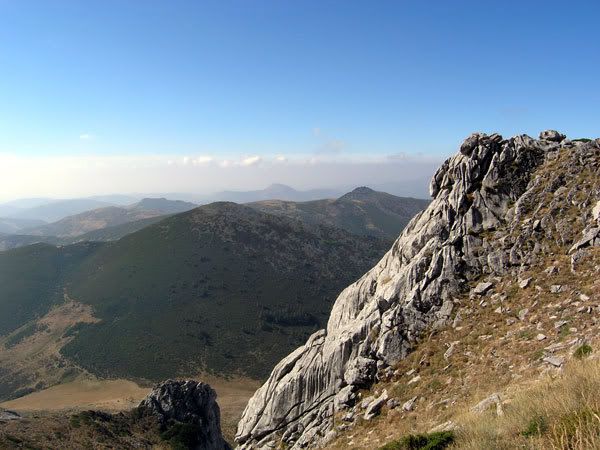
As I may have mentioned, prior to my holiday my life was taken over by marking and viva-ing a breeding population of undergraduate mapping projects. These projects are a major part of the third year, and are a required component of any certified geology degree, and in a week’s time, I’m heading out to the Cantabrians in northern Spain to get some of next year’s students started on their 30 days in the field. As a preparation for that, I’ve written a list of tips and pointers collated from weaknesses (and strengths) I perceived in the projects I marked; the comments of the external examiners at the exam board meeting I sat in on last week; and reminiscences of my own mapping project, way back in the summer of 1999, which I used to guide my marking (as per usual, the guidance I was given by the department was a little…. sparse). It’s probably not of particular general interest, but you never know.

The aim of mapping


The ultimate aim of the project is not the map. Your goal is to uncover the geological history of the mapping area, principally:
  • The sequence of deposition of the different formations, and the environmental and tectonic changes which have produced these distinct rock types.

  • The structures (faults and folds) which have led to the present distribution of the different formations, and the tectonic events which produced them.

A good map is essential for developing this understanding, but if you confine your fieldwork to simply colouring the distribution of outcrop, you’re making it difficult for yourself.

Thinking and hypothesising in the field


There are various scales of observation to consider when you’re recording the geology at a particular locality, from whole outcrop to hand lens. When mapping, you also have to think about the biggest scale of all: regional context. As well as the obvious (e.g., ‘this is 200m downstream from the last locality’), you should always be asking yourself, what’s going on at this locality compared to the last one you saw, and others nearby? Can you explain any changes in rock type, or structure? It is especially important to properly record such observations. If a formation you don’t expect suddenly appears, note down that it’s unexpected. Record and sketch any ideas you might have about what’s going on, and what you might find at the next outcrop if your idea is right. Then go and have a look. Even if you never do field geology again, this is great experience of doing real science.

Field slips as working documents


Field maps are not something to passively colour in outcrop on; you should be trying to infer boundaries, and drawing them on, as early as possible (the same is true of faults, folds etc.), preferably as you are mapping them. Doing this turns your field slips into a powerful tool to guide your mapping, allowing you to visually check, whilst you are still in the field, whether what you are observing makes geological sense, and highlighting areas that you will need to concentrate on to sort out what’s going on. It’s far easier to do something about problems and missing data out there, than months later back home.

Annotation of your field slips is also important – if you’re inferring a boundary due to a break in slope, or a change in vegetation, then record this on your field slip. If you have observed a good exposure of a fault plane, or an unconformity, highlight it. All of this tells a marker that you are doing geology, rather than colouring in.

Don’t be a slave to the literature


In your final project, you will be expected to justify all of your conclusions and interpretations in terms of what you have actually observed in the field. It's fine to compare what you have seen to what is stated in the literature, but published research is not a substitute for your own observations – even (especially!) if they disagree. Like any geologist, the authors of papers about your mapping area have pieced together the history of the area from incomplete information, inferring boundaries and structures where there was no exposure. What is more, their research usually encompasses a much larger area in far less detail, meaning that the observant undergraduate might well see features, structures, and even outcrop that they did not. This new information might change your interpretation completely, indicating that in your area at least, things were different from the published interpretation (you should also bear in mind that general conclusions for a larger region may not be a good fit for your specific area).*

Observation and interpretation in your notebooks


Third year students shouldn’t need reminding about separating interpretation from observation, but they do need to be aware of the biggest enemy they will face in their 30 days in the field – boredom, the effect of which is to make people forget about the observing part and move straight on to the interpretation.

Day 28, and you come across an outcropping of limestone. It looks like a formation you’ve seen a hundred times by now, it’s about where you expect it to be. You write in your notebook, “Locality 278. Exposure of Intractable Limestone Formation,” record any structural information, and move on. The only problem is, assigning a formation is an interpretation, and it has been written down without recording the lithology, fossil content, and other observations which explain why you think it is that formation. Months later, you start to suspect that at that outcrop it was the Inscrutable Limestone instead of the Intractable Limestone. If you have recorded your primary observations, you can check this – you may see that at this particular outcrop you didn’t see the fossils characteristic of the Intractable, making it possible you misidentified it. If you just have a formation name, you’re stuck.

So work hard to maintain the quality of your notebook. After 30 days, you can’t possibly remember everything you’ve seen in your area; you will need to have it all written down so you can refer back to it.

What you should (and shouldn’t) be doing in your evenings


There is a growing trend for students to put very little on their maps, and sometimes even in their notebooks, in the field, only to waste hours reproducing immaculate versions of what they have seen in the evenings. What you will get for all this effort is suspicious markers, who want to see evidence that the field slips are being used, as I have already discussed. Filling in as much information as possible as you go means that in the evening all you should have to do is make sure that everything is legible and inked in, freeing up time for what you should be doing, namely thinking. Did you understand what you have seen today, or are there still areas you don’t grasp? Does it fit in with your current understanding of the whole area? It goes without saying that you should write down these thoughts in your notebook.

Cross-sections


Ah, the term which strikes fear into the heart of every undergraduate - which is all the the more reason not to leave it until you’re writing up before thinking about them. From the very beginning you should be devoting some of that evening thinking time to sketching cross-sections. Amongst other things, this is another check on whether you’ve mapped things correctly – projecting things into the third dimension can reveal problems which aren’t immediately obvious in plan view.

Although within a week you should have enough information to produce a reasonable first stab at a section through your area, a fully accurate one will require a lot of structural data along the line of section. It is a really great idea to select a sensible cross-section line (or lines) before you finish in the field, then take a day to traverse it (or them), checking that what you see agrees with your map, and that you have enough structural data to properly constrain things. Again, this can reveal problems with your map which are much easier to fix out there than back here.

Sketches or photographs?


Both. If you have a digital camera, it’s very tempting to rely on cold hard optics rather than your own sketches, and it’s certainly true that a photo can record more detail, more accurately, than all but the best of us can manage with a pencil. But there is a lot of interpretation involved in the process of sketching – you are picking out and highlighting the most important features of the outcrop. You can’t do this when taking a photograph, which means that when you look at again it’s very easy to forget what it is supposed to show. A photo cannot replace a sketch, but it does complement it, and vice versa.

Small-scale tells us about large-scale


Because rocks tend to deform at all scales, clues to the overall structural style of an area can often be found by looking at features of smaller scale folds (e.g., shape, vergence) and folds (e.g., orientation, sense of displacement from slickensides). Detailed measurement of these features can be very useful.

So endeth the lesson.

*I didn’t get anywhere with my own mapping in North Wales until I folded up the BGS sheet for the area and put it at the bottom of my bag for the rest of my trip. It just wasn’t at a small enough scale to properly represent all the details I was finding – for example, it had a lot of random faults running through my area, when I thought there was a lot more regularity there. As it turned out, there was.

25 June, 2006

What makes a good science teacher?

Not content with assimilating science-inclined bloggers left, right and centre into the looming Scienceblogs collective, Seed Magazine also regularly demand tribute, asking them all to answer weekly questions in their own idiosyncratic styles (see here for previous examples). This week’s asks, ”What makes a good science teacher? All the responses will be eventually collated here, but as this is a question that I have been struggling with for the last 10 months or so, I thought I’d just point out some common themes in the answers so far, and add my perspective on them.

Corturnix at A Blog Around the Clock says that one of the keys is to know your subject.

Knowing your material inside and out, at least a hundred times better than the students or the textbook - that certainly helps, not just in answering potential questions, but also in the degree of self-confidence one brings to teaching.

This is especially important for me, because I’ve found it almost impossible to use pre-written notes effectively; even if I have them, once I've started talking I forget that they are there. And whilst this potentially leads to a much more flowing lecturing style, it’s also much easier to start rambling if you don’t know the material inside-out.

More importantly, I’ve found that you can understand a concept well enough to use it every day, and that still doesn’t mean you can teach it effectively. Your route to understanding something often involves all sorts of mental short-cuts which make perfect sense to you as a (relative) expert, but will quickly lose a novice. Spotting these is very important; as Jason Rosenhouse at EvolutionBlog puts it:
The key to good teaching is an ability to put yourself in the position of someobody learning the material for the first time.

Mike the Mad Biologist agrees:
A good teacher has to know what students don't know.

Or, as someone told me to my chagrin on a field trip (regarding some lectures I’d done the previous term):
You came across as knowing what you were talking about, but that didn’t mean we always understood it.

Sometimes that isn’t just about poor explanations though, it could be that the students can’t work out what the point is. As the Evil Monkey opines at Neurotopia:
If I had to decide what makes a good science teacher, it would be the ability to demonstrate how experiments fit into the proverbial "scheme of things". Nothing kills interest in science faster than 1. not being able to accurately relay the structure of the big picture and 2. just tossing a bunch of apparently random experiments at the students and expecting them to figure out how the pieces fit together. You wouldn't attempt to put a jigsaw puzzle together in the dark, would you?

Concurrently, at Good Math, Bad Math, MarkCC says (about maths teaching, but I think this is generally applicable to all sciences):

But it's very easy to get caught up in the abstraction, and forget why you're doing it. Good math teaching is a subtle act of balance: you're studying abstractions, but you need to keep the applications of those abstractions in sight in a way that lets your students understand why they should care.

Case studies, drawing examples from published research to show how the concepts you’re talking about are tools, with clear uses, are important in this regard (in geology, I’m helped greatly by the fact that it’s not usually too difficult to link even the most theoretical stuff to the ‘real world’). In lectures, narrative is a great way to hold attention: show a problem which scientists set out to solve, before showing that the concepts you’re teaching about were essential in solving it. Such a structure also naturally incorporates insights into how science works, which Dr. Free Ride at Adventures in Ethics and Science thinks is the most important thing of all:
In the grand scheme of things, the most important knowledge for the science teacher to transmit has to do with methodology rather than a laundry list of facts (especially since lots of the facts get updated). And the methods of scientific inquiry are not completely divorced from common sense. Building on the continuities between the two is a good way to get the kids who may not grow up to be scientists a good appreciation of how science works.

And I’ll give her the last word too, as she admonishes those of use who fall back on the old ‘science is hard’ shctick to compensate for the fact that only the really bright ones seem to follow you.
… if you're a teacher, your goal when you walk into the classroom should be to teach all the students whatever it is you're charged with teaching them. We don't always meet our goals, but dammit, at least try!

*blush*

27 May, 2006

Viva'd out

Last week I finally managed to break the back of all my marking and, most importantly, the viva-ing. I've ended up doing much more than I expected, mainly because I rather foolishly agreed to cover for the single person in the department who is taking this whole lecturer strike seriously, more than doubling my workload at a stroke. The powers that be are paying me extra for this, but at several points in the last week or so I've wondered whether it was really worth the lost weekends and evenings.

The vivas themselves were an interesting experience. I have to confess to feeling a slight discomfort with the whole thing; here I was, passing judgement on the efforts of people I don't feel much older than, with my opinion having equal weight to that of the other, much more experienced marker. I did worry that they might chafe a bit at the situation, but that didn't seem to be a problem. For my part, it was interesting to see how the second markers focussed on different things in the vivas themselves. Some concentrated on narrrow technical issues, others on more general interpretation stuff - there was almost as much variety here as in the how the students coped. On that side of things, there was surpises both pleasant and unpleasant: it was great when they came in well-prepared, and showed a much better understanding than you expected, it was less good when they came in and threw random keywords together in the hope that some glimmer of sense would emerge (in much the same manner that many of them seemed to have written their reports).

As well as all of that, I also had to give a double lecture last Friday, ironically to the same third year who I have been viva-ing. It was also the last lecture of the semester for them (and hence for some, their last lecture ever), so there was a definite 'end of term' atmosphere which probably didn't do much for their attention spans. Still, hopefully I did enough to ensure they ended on a medium.

Anyway, I can't complain about not having anything to do at the moment, that's for sure, and my self-indulgent vanity projects (to wit, this blog) have suffered as a result. Hopefully I'll get back to having some spare time soon.

05 May, 2006

Marking madness

My (very) small band of semi-regular browsers might have noticed a slight drop in posting frequency over the last couple of weeks. This has not only been due to the first inklings of semi-nice weather drawing me away from the keyboard (although they haven't helped); I'm also completely snowed under marking undergraduate mapping projects. This is a rather time-consuming affair: each one consists of field slips, notebooks, an interpretative map and a report, which you have to constantly cross-refer between to check the interplay between observations and interpretations (is a strange interpretation due to a mistaken observation, or just poor extrapolation from sparse data?). I've never had to mark this sort of thing before, so am finding it even more slow going. In fact, I've been more than a little perturbed about the lack of guidance I've got - these things were effectively dumped on my desk and I was told, "Go mark". Given that these projects form a sizeable percentage of the students' final year mark, it's important to get them right, and I worry that my inexperience may cause difficulties (it's also yet another example of me being given responsiblities seemingly far beyond those you'd expect for my present position or salary, but that's actually a minor irk in this case, as I can see the experience will improve my teaching). I was reassured by the fact that they were being double-marked, and that the students would also have a viva, or oral exam, to help assess their performance.

Yes, I was reassured - until I found out yesterday who is doing the vivas.

Me.

Erm.

I'm not sure what's more scary: the thought that the department trusts me with such things, or the thought that it's more because they can't get anyone else to do them.

26 April, 2006

Murphy's Law strikes again

I've had a fairly mad few days this week. Yesterday morning I had to present a double lecture in a "short fat course". "Short fat" roughly translates as "cram a whole terms' worth of material into two intensive weeks, and hope some of it hammers its way into the students' little brains". I'm yet to be convinced of the merits of this approach - it just seems to play into the students' preference to only actually retain what you're trying to teach them until they've passed the course, after which they can (and do) promptly forget it.

This particular course is entitled "Formation and evolution of the ocean crust", and I was obviously down to do the magnetism - the source and origin of the "magnetic stripes" and what they tell us about plate tectonics, the behaviour of the Earth's magnetic field over time, and construction of the oceanic crust (which, now I think of it, would make a rather nice series, if I ever get the time).

Anyway, I was asked to do this lecture at rather short notice, so I had to work quite hard to get the reading done, then sort out the presentation. It was tight, but by yesterday morning I had just about got everything ready - all I had to do was print and photocopy the handouts. Sadly, I then ran into the universal law of printers - they always stop working when you really need them. Leaving it until half an hour before the lecture starts to print the handouts certainly qualifies.

An hour of running around the building between various computers and printers, the lecture room and the IT department later, I had my handouts, as well as severely elevated blood pressure and adrenalin levels. I'm just thankful I brought in my laptop to run the presentation from...

10 April, 2006

It's official - I don't totally suck at lecturing

While I'm working on sorting out the photographic highlights of the Spain field trip, I though I'd share some more good news with you. Student feedback from one of the courses I lectured last semester is in. One of the things the students are asked to do is to rate each lecturer, with possible scores ranging from 1 (poor) to 5 (excellent). My mean score was 3.8. Not great, but I was expecting much worse!

This has cheered me up no end - these were my first lectures, and I learnt an awful lot from them: the importance of preparation, of having a coherent narrative, and the judicious use of worked examples and case studies. Talking to some of the students on this field trip (who I lectured in a different course) also provided me with some useful feedback, reminding me how easy it is to pitch the level just too high - perhaps by not properly explaining terminology - and therefore lose a large part of the audience (which may not bode well for the feedback from that course...). It was a precipice-like learning curve, and I wasn't particularly confident that I'd ascended fast enough to really be any use at all, especially after seeing the students' exam papers. Knowing I wasn't too appalling, whilst realising that I can do much better with a bit of work, is helping to ease my current existential crisis.

06 February, 2006

Must try harder

The last few days have been a little depressing. I spent the week wearing my academic hat, marking the exams for the courses I taught last autumn, and it has been a thoroughly dispiriting experience.

Because they were – almost uniformly – awful.

That’s not a statement I make lightly; I just can’t think of anything good to say about them. In both of the courses I taught, it wasn’t just the factual errors that I had to contend with, but also the apparent inability of many of the students to actually express their thoughts in a coherent manner. For the essay questions, I was expecting something with an introduction, a presentation of relevant material, and a conclusion.
What I got in many cases was a haphazard scatter of (often wrong) statements, barely linked to those that preceded and followed it, and which if I was lucky had some relevance to the question that was being asked.

This situation has been preying on my mind, as I wonder how much of the blame for the students’ poor performance rests with me. In the past I’ve chuckled along with everyone else at the lists of student howlers which often accompany the release of the GCSE and A-Level results; but it’s not quite so funny when the students almost heroically getting the wrong end of the stick are ones that you’ve taught the stuff to. In my inexperience, was I so dire, so incoherent, that no-one learnt anything from my lectures?

I can’t deny the possibility that I may have been a contributing factor to the low level of understanding apparent in the answers. But can I be blamed for the laziness, the sheer lack of ambition, apparent in the essays? Perhaps I can. The lectures went little beyond a recital of basic facts and concepts, with very little referral to current research. Particularly for the third- and fourth-year course, is that not a lack of ambition? The lecture handouts were print-outs of Powerpoint slides. Is that not lazy?

In my defence, I inherited these lecture courses, Powerpoint presentations and all. I felt a little guilty at the time about how content-light they seemed to be, but I didn’t really have time to put much of a mark on them before I had to give them. I’m resolved, should I do any more lecturing, never to let that happen again. I must try harder.

But still. I wasn’t the sole lecturer on either course. Other, more experienced, people taught different bits, and set their own exam questions; the students didn’t have to answer mine. Yet they did. The questions I set weren’t difficult or obscure, and I wasn’t expecting knowledge outside of what was in the lectures; so even if I was appalling, at least some people should have been able to glean enough from the lecture notes and reading textbooks to get a decent mark. However much knowledge the students did (or didn’t) have, they should have at least been able to write about it in a clearer manner. Why didn’t they? I fear the answer might lie in one word: scaling. Bad marks make the department look bad, so the distribution of my marking will be shifted upwards. The adequate will become excellent. The awful will become merely poor. And the students will believe that the quality of their answers, and the level of their revision, was acceptable. What, then, motivates them to improve? From their perspective, they don’t need to.

Scaling is self-defeating. If we want the students to try harder, we have to make it clear that we won’t accept it if they don’t.

30 November, 2005

Lava lake tectonics

Part of the duties of my new job is some lecturing on behalf of my supervisor (now boss, I suppose). I'm finding this a bit daunting, even if I have been given Powerpoint presentations for each lecture; this means at least I don't have to compile things from scratch, although it does take a while to remove all the instances of text zooming in with a swooshing sound (another crime against humanity perpetrated by Microsoft).

My first lecture started with a discussion of why we have tectonic plates, and I got to present a really cool example of a situation where similar processes are occurring over timescales much easier for us to grasp conceptually. All the pictures in this post come from a lava lake in the crater of Erte Arle volcano in Ethiopia. You get lots of the sorts of activity you’d associate with such an environment (such as fountain eruptions and bubbling molten lava), all occurring as the lava is heated from below and the hotter, less dense, material forces its way to the surface. However, what's even more interesting is that a lot of the time the surface of the lake is formed by a solid crust of cooled magma. Vigorous convection is still occurring beneath this crust, and in response to this the crust breaks up into a number of discrete slabs.


Sound familiar? The relationship between the lava crust and the convecting molten lava beneath it is precisely the same as that between the lithosphere and the asthenosphere - the convecting and non-convecting parts of the Earth's mantle. In both cases the boundary is controlled not by composition but by temperature - contact with the air has cooled the upper part of the lava lake so that it solidifies and begins to act rigidly; heat loss through the Earth's surface causes the same thing to happen to the upper 100 km or so of the mantle.

The internal strength of the lava 'plates' compared to the molten material beneath them causes them to move coherently over the surface of the crater, with little frictional drag at their base to slow them down, or dissipate any forces which are applied to them. In such a situation the forces exerted at the boundaries of the slabs become particularly important. Again, the same situation seems to apply for the tectonic plates on the Earth's surface, so it is no surprise that you can see analogues of different types of tectonic plate boundaries at the borders of the lava slabs. Here's a rift zone, where two slabs are moving apart:


The orange crack shows where lava is welling up to the surface of the lake. It cools and solidifies and is itself pushed away from the rift by yet more upwelling magma. Notice the symmetrical pattern of light and dark grey bands moving away from the crack - this is caused by slight variations in the composition of the upwelling magma over time (and is very reminiscent of the striped magnetic anomalies seen either side of a mid-ocean ridge).

The force pushing the slabs apart at this boundary will be transmitted to the opposite boundaries of the two slabs, where they will be pushed against their neighbours. In such a situation one plate is forced beneath the other, forming a 'subduction zone' (in the picture below, the lava slab is being pushed against the crater wall, but the principle remains the the same):


The best thing about this example, though, is that molten lava has a much lower viscosity than asthenospheric mantle, flowing at centimetres per second rather than centimetres per year. This means that you can see the equivalent of hundreds of millions of years of tectonic processes occurring in the space of a few hours. This movie (Quicktime) was created using time-lapse photography: as evening draws in, plates on the surface of the lava lake are created and die, move apart and push together. It's really cool. Watch it.